Tsunami Awareness Day: Risk Reduction Strategies

In 2020, World Tsunami Awareness Day encourages the development of national and community-level, local disaster risk reduction strategies to save more lives against disasters. This year’s observance promotes ‘Sendai Seven Campaign’.
By the year 2030, an estimated 50 per cent of the world's population will live in coastal areas exposed to flooding, storms and tsunamis. Having plans and policies in place to reduce tsunami impacts will help to build more resilience and protect populations at risk.
In December 2015, the UN General Assembly designated 5 November as World Tsunami Awareness Day, calling on countries, international bodies and civil society to raise tsunami awareness and share innovative approaches to risk reduction.
World Tsunami Awareness Day was the brainchild of Japan, which due to its repeated, bitter experience has over the years built up major expertise in areas such as tsunami early warning, public action and building back better after a disaster to reduce future impacts. UN Disaster Risk Reduction (UNDRR) facilitates the observance of World Tsunami Awareness Day in collaboration with the rest of the United Nations system.
Tsunamis are rare events but can be extremely deadly. In the past 100 years, 58 of them have claimed more than 260,000 lives, or an average of 4,600 per disaster, surpassing any other natural hazard. The highest number of deaths in that period was in the Indian Ocean tsunami of December 2004. It caused an estimated 227,000 fatalities in 14 countries, with Indonesia, Sri Lanka, India and Thailand hardest-hit.
Just three weeks after that the international community came together in Kobe, in Japan’s Hyogo region. Governments adopted the 10-year Hyogo Framework for Action, the first comprehensive global agreement on disaster risk reduction.
They also created the Indian Ocean Tsunami Warning and Mitigation System, which boasts scores of seismographic and sea-level monitoring stations and disseminates alerts to national tsunami information centres.
Rapid urbanization and growing tourism in tsunami-prone regions are putting ever-more people in harm’s way. That makes the reduction of risk a key factor if the world is to achieve substantial reductions in disaster mortality- a primary goal of the Sendai Framework, the 15-year international agreement adopted in March 2015 to succeed the Hyogo Framework.
What are Tsunamis?

The word "tsunami" comprises the Japanese words "tsu" (meaning harbour) and "nami" (meaning wave). A tsunami is a series of enormous waves created by an underwater disturbance usually associated with earthquakes occurring below or near the ocean.
Volcanic eruptions, submarine landslides, and coastal rock falls can also generate a tsunami, as can a large asteroid impacting the ocean. They originate from a vertical movement of the sea floor with the consequent displacement of water mass.
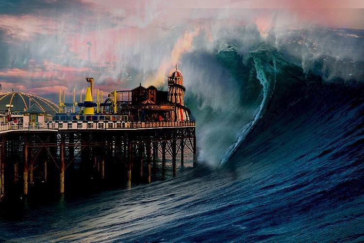
Tsunami waves often look like walls of water and can attack the shoreline and be dangerous for hours, with waves coming every 5 to 60 minutes.
The first wave may not be the largest, and often it is the 2nd, 3rd, 4th or even later waves that are the biggest. After one wave inundates, or floods inland, it recedes seaward often as far as a person can see, so the seafloor is exposed. The next wave then rushes ashore within minutes and carries with it many floating debris that were destroyed by previous waves.
Causes of Tsunamis
Earthquakes
It can be generated by movements along fault zones associated with plate boundaries.
Most strong earthquakes occur in subduction zones where an ocean plate slides under a continental plate or another younger ocean plate.
All earthquakes do not cause tsunamis. There are four conditions necessary for an earthquake to cause a tsunami:
1. The earthquake must occur beneath the ocean or cause material to slide into the ocean.
2. The earthquake must be strong, at least magnitude6.5 on the Richter Scale
3. The earthquake must rupture the Earth’s surface and it must occur at shallow depth – less than 70km below the surface of the Earth.
4. The earthquake must cause vertical movement of the sea floor (up to several metres).
Landslides
A landslide which occurs along the coast can force large amounts of water into the sea, disturbing the water and generate a tsunami. Underwater landslides can also result in tsunamis when the material loosened by the landslide moves violently, pushing the water in front of it.
Volcanic Eruptions
Although relatively infrequent, violent volcanic eruptions also represent impulsive disturbances, which can displace a great volume of water and generate extremely destructive tsunami waves in the immediate source area.
One of the largest and most destructive tsunamis ever recorded was generated in August 26, 1883 after the explosion and collapse of the volcano of Krakatoa (Krakatau), in Indonesia. This explosion generated waves that reached 135 feet, destroyed coastal towns and villages along the Sunda Strait in both the islands of Java and Sumatra, killing 36,417 people.
Extra-Terrestrial Collisions
Tsunamis caused by extra-terrestrial collision (i.e. asteroids, meteors) are an extremely rare occurrence. Although no meteor/asteroid-induced tsunamis have been recorded in recent history, scientists realize that if these celestial bodies should strike the ocean, a large volume of water would undoubtedly be displaced to cause a tsunami.
Reflecting Japan’s long history of disaster experience and commitment to DRR (Cabinet Office 2015) all three world conferences on disasters were held in Japan.
The 1st World Conference on Natural Disasters in Yokohama (1994) led to the Yokohama Strategy (IDNDR 1994).
The 2nd World Conference on Disaster Reduction (2005) in Kobe City, Hyogo Prefecture, 10 years after the 1995 Great Hanshin Awaji Earthquake, resulted in the Hyogo Framework.
The 3rd World Conference on Disaster Reduction (2015) in Sendai followed years of devastating disasters including: earthquakes in Gujarat (2001), Bam (2003), Kashmir (2005), Sichuan (2008), and Haiti (2010); Cyclone Nargis in Myanmar (2008); and tsunamis in the Indian Ocean (2004) and after the Great East Japan Earthquake (2011).
In response to this overwhelming damage and with the mission to actively reduce future losses, the SFDRR builds on previous DRR guidelines while departing from them in several significant aspects:
(1) The SFDRR focuses on practical and measurable outcomes for reducing disaster losses, including indicators to measure progress towards seven specific global targets.
(2) The SFDRR strongly emphasizes a localized and people-centred approach and inclusivity of all people in disaster prevention and response processes, with sensitivity to gender, age, (dis)ability, and indigenous and vulnerable populations.
(3) The SFDRR supports crosscutting issues and mainstreaming DRR and an approach that links disaster prevention, response, recovery, and development needs.
(4) The idea of resilience in recovery features prominently in Priority 4, with a call to “Build Back Better” in recovery, rehabilitation, and reconstruction.
(5) The SFDRR specifically mentions several key issues: climate change and development; education and health; and biological and technological disasters, as well as disasters resulting from natural hazard events.
The seven global targets of the SFDRR, including numerical goals and timelines for achievement, can be summarized as follows:
- Substantially reduce global disaster mortality;
- Substantially reduce the number of affected people globally;
- Reduce direct disaster economic loss;
- Substantially reduce disaster damage to critical infrastructure and disruption of basic services, among them health and educational facilities;
- Substantially increase the number of countries with disaster risk reduction strategies;
- Substantially enhance international cooperation with developing countries;
- Substantially increase the availability of, and access to, multi-hazard early warning systems and disaster risk information and assessments to the people (UNISDR 2015).
Towards these seven targets, the SFDRR includes four priorities for action:
Priority 1: Understanding disaster risk;
Priority 2: Strengthening disaster risk governance to manage disaster risk;
Priority 3: Investing in disaster risk reduction for resilience;
Priority 4: Enhancing disaster preparedness for effective response and to “Build Back Better” in recovery, rehabilitation and reconstruction (UNISDR 2015).
Emphasizing people-centred and community-based approaches, the Sendai Framework represents a significant shift toward an inclusive all-of-society perspective that recognizes the importance of awareness of the needs of society’s poorest members, along with integrating “a gender, age, disability and cultural perspective in all policies and practices” (UNISDR 2015, p. 13).
Building on previous guidelines, the SFDRR reflects new approaches and roles for practical disaster science to reduce risks in quantifiable ways with objective targets.

Although the underlying mandate of the SFDRR is risk reduction to reduce damage, recovery features prominently in Priority 4, where strong connections are made between DRR, recovery, and development. As the scope and purpose states, the Sendai Framework “aims to guide the multi-hazard management of disaster risk in development at all levels as well as with and across all sectors” (UNISDR 2015, p. 11).
Drawing on past precedents, current reconstruction projects and processes will have major long-term impacts on the region and offer valuable lessons for future recovery programs. Drawing on past events and previous knowledge, the GEJE showed the limitations of tsunami engineering for hazard mitigation and led to engineering advances.
Lessons from the GEJE include various engineering measures for improved tsunami warning and observation, mapping, and analysis, considered in the light of five tsunamis that have struck Japan and Indonesia in the last two decades: the 2004 Indian Ocean tsunami; the 2011 Great East Japan tsunami; the 2016 Fukushima tsunami; and the 2018 Sulawesi tsunami and the 2018 Sunda Strait tsunami in Indonesia.
Progress in tsunami risk understanding and awareness is evaluated based on the approaches presented in the SFDRR, especially Priority 1: Understanding disaster risk; and Priority 2: Strengthening disaster risk governance to manage disaster risk; as well as Global Targets (a) Substantially reduce global disaster mortality; and (g) Substantially increase the availability of, and access to, multi-hazard early warning systems and disaster risk information and assessments to the people (UNISDR 2015).
With a complex, long-term, and ongoing recovery, the case of the GEJE highlights the connections and relationships between DRR and recovery and the implications for resilient outcomes. Considered in light of the Sendai Framework, the discussion of recovery focuses on the guidelines in SFDRR Priority 4: Enhancing disaster preparedness for effective response and to “Build Back Better” in recovery, rehabilitation and reconstruction.
For both the tsunami risk reduction and recovery perspectives, lessons learned from the GEJE are considered in the context of previous as well as subsequent events. The situation and progress are evaluated based on the Priorities and Global Targets of the SFDRR. Lessons from the GEJE from both the perspectives of
(1) pre-disaster tsunami hazard risk; and
(2) post-disaster recovery and vulnerability are considered in terms of the seven global targets to clarify the current situation and progress.
The Sendai Framework and Tsunami Engineering for Risk Reduction
Efforts to address tsunami hazards focus on (1) hazard warning; (2) mapping; and (3) risk assessment.
Tsunami Observation and Warning Systems
Based on the GEJE experience, Japan revised several aspects of the tsunami warning system and increased the number of offshore sensors that can detect tsunami activity. However, the 2016 Fukushima tsunami and the two tsunamis that occurred in Indonesia in 2018 showed limitations for detecting and disseminating warning information for tsunamis caused by non-seismic disturbances such as volcanic eruptions or underwater landslides and not directly by undersea earthquakes.
New Dense Tsunami Observation System
At the time of the GEJE, the number of offshore GPS observation buoys was limited. To allow more warning and evacuation lead time, Japan has developed a new real-time tsunami observation system “S-net” (Aoi et al. 2019), deploying 150 new tsunami sensors along the Tohoku coast extending to the Japan Trench and its eastern part to respond to outer-rise earthquakes.

The Japan Meteorological Agency (JMA) is required to issue the initial tsunami warning within 3 minutes (JMA 2019b). It is expected that using S-net will significantly improve the accuracy of subsequent warning messages. Information from S-net is currently used in many research projects that are creating predictions of real-time tsunami inundation maps to be sent to residents in advance.
The S-net system is also very useful for non-seismic tsunamis (like the 2018 Sulawesi tsunami and the 2018 Sunda Strait tsunami) because all other current tsunami warning systems around the world rely on assumed earthquake sources and related fault parameters (Suppasri et al. 2016).
After the GEJE, it seemed that the east coast of Japan was much better prepared for tsunamis and that S-net represented significant improvements in tsunami warning accuracy.
However, the 2016 Fukushima tsunami demonstrated the limitations of S-net, because the epicentre was in a shallow area between the shallowest S-net sensor and land, outside the coverage area. In addition, the JMA’s assumed fault parameter (fault orientation) used in the pre-calculated tsunami warning database differed from what actually happened (Suppasri et al. 2017), causing an underestimation of tsunami height.
After the 2016 Fukushima tsunami, the JMA investigated other potential earthquakes near this area and updated the fault parameters used in the tsunami database.
At the time of the 2016 Fukushima tsunami, the JMA initially issued a “tsunami advisory” but the warning level was suddenly increased to “tsunami warning” two hours later. The JMA’s own evaluation acknowledged that this situation is very rare (Suppasri et al. 2017). This was also the first tsunami warning issued since the GEJE.
With no guidelines for this situation, local municipalities were unsure if they should remain at the advisory level or move to the warning level. They each made their own decision, leading to confusion for local governments and residents.
Revision of Tsunami Warning Levels and Warning Messages
To simplify the complicated system of eight tsunami warning levels that existed in 2011, warning levels in Japan were reduced to five levels. It was also decided that warnings will be issued for “tsunami” or “large tsunami,” rather than exact estimated tsunami heights, to avoid comparisons between heights of tsunami and ground elevation or seawalls, leading to delays or failures of evacuation. A new type of warning called “emergency warning” was also created, which requires coastal residents to evacuate in the case of a three meter or higher tsunami (JMA 2019a). Some aspects of risk communication still need improvement to ensure that local people can correctly understand complex scientific information and respond appropriately.
Future Challenges for Non-Seismic Tsunamis
Two non-seismic tsunamis that occurred in Indonesia in 2018 showed other existing problems related to these unusual tsunamis, which have complex generating mechanisms and are very rare and hard to predict. The 2018 Sulawesi tsunami was caused by a strike-slip earthquake with a magnitude of 7.4.
Although strike-slip earthquakes (horizontal movement) are generally understood not to generate large tsunamis, the earthquake caused aerial (land into the sea) and submarine (undersea) landslides and several local tsunamis that killed more than 2000 people (Pakoksung et al. 2019).
One tide gauge station near the epicentre recorded a large tsunami that arrived after five minutes but this information could not be seen or used for proper warning messages because of power failures.
Another non-seismic tsunami, the 2018 Sunda Strait tsunami, was generated by a large-scale flank collapse after the eruption of the Anak-Krakatoa volcano, causing human casualties and extensive damage to Sumatra and Java islands (Syamsidik et al. 2019). With no early natural warnings such as strong ground shaking as in an earthquake, no tsunami warning was issued.
Currently, the Indonesian government is considering the deployment of more tsunami observation sensors and strengthening tsunami education to improve coastal evacuation.
Tsunami Hazard Assessment and Tsunami Hazard Maps
Global Tsunami Model (GTM) and Probabilistic Tsunami Hazard Analysis (PTHA)
The Global Tsunami Model (GTM) was established in 2015 (GTM 2019), similar to the previously established Global Earthquake Model (GEM) and the Global Volcano Model (GVM). The GTM comprises global tsunami expertise from various fields, including tsunami source determination, tsunami hazard and risk assessment, and knowledge dissemination.
Toward the goal of the GTM to establish a global standard for Probabilistic Tsunami Hazard Analysis (PTHA) and the results of risk assessments, more research is still needed on some topics, such as the understanding of non-seismic tsunamis and more detailed global risk assessments.

Based on new knowledge and information of tsunami sources from crustal movements, the use of PTHA contributes to improved understanding of tsunami deposits and earthquake sizes and their recurrence. Because of limitations of computational costs, the PTHA models offshore (50–100 m sea depth) tsunami amplitude based on future tsunami events, applying probabilistic methods.
Probabilistic Tsunami Hazard Analysis provides information such as “an n xxx m tsunami will repeatedly occur every roughly xxx years” or “within xxx years, about a xxx m tsunami is expected.” Such information is important in designing heights of coastal defence structures and hazard risk areas for purposes of evacuation and land use planning.
Shortly before and since the establishment of the Sendai Framework, a number of research projects have applied PTHA to tsunami assessment at a global scale (Davies et al. 2017), regionally in the Pacific (De Risi and Goda 2016) and Indian (Horspool et al. 2014) oceans, and locally (González et al. 2014).
Nevertheless, PTHA contains uncertainties of earthquake sources, bathymetry data, and assumptions in numerical simulation. In addition, PTHA only provides offshore tsunami amplitudes from estimated earthquake scenarios. Inland tsunami inundation might be higher than that specified by PTHA, and non-seismic tsunamis might generate larger local tsunamis.
Inland Tsunami Inundation Mapping
Most tsunami hazard maps underestimated the areas affected by the GEJE. Updated hazard maps were created for the Tohoku area using the actual 2011 tsunami-inundated area. For other areas in Japan, earthquake sources were comprehensively recalculated with larger earthquakes to create new hazard maps.
New tsunami hazard maps published after the GEJE were updated to include simulated flow velocity, inundation zones with different recurrence, and ground elevations (Fukutani et al. 2018).
The main challenge for inundation mapping is the detailed topography and bathymetry data (that is, 10 m resolution or less) used for numerical simulation (Suppasri et al. 2016). While improved maps with greater accuracy can be seen as a good practice in Japan, in many countries such detailed data are not available or cannot be used or shared due to security or political issues.
Research on the relationship between tsunami characteristics and human casualties and building damage was substantially advanced after the 2004 Indian Ocean tsunami. Information about lives lost in Banda Aceh, Indonesia was collected at the village level, and casualty ratios for each village were calculated using population data.
Fragility functions for human fatalities were developed by compiling casualty ratios and simulated tsunami flow depth (Koshimura et al. 2009). For the GEJE, more detailed casualty data were collected up to street level, with other information such as sex and age that allows further investigation of this relationship between the location of casualties and the depth of the tsunami in that location (Latcharote et al. 2018).
A new project on this issue was started in 2018 using detailed death data provided by the Miyagi Prefectural Police. These data contain personal information (sex and age), residential address, and locations where bodies were found, as well as under what conditions (inside a car, in the sea, and so on). Used to clarify causes of death (Seto et al. 2019), these data are geospatially compiled with tsunami characteristics and other parameters for further investigation. Through this improved understanding, better ways of saving lives from tsunamis can be proposed.
Tsunami Simulation Techniques and Damage Estimates
Relationships between simulated tsunami flow depth, flow velocity, and hydrodynamic forces against building damage ratio were used to empirically develop tsunami fragility functions in Indonesia (Koshimura et al. 2009) and Thailand (Suppasri et al. 2011).
Because of the limited level of detail of the survey data, various fragility functions for different building types could not be developed. After the GEJE, very detailed building damage surveys allowed for the development of tsunami fragility functions with different building materials, numbers of floors, construction years, and functions (house, apartment, shop, school, hospital, and so on) (Suppasri et al. 2015a).
In this sense, the new tsunami fragility functions allow increasingly accurate damage assessments that can be used for further loss assessment and urban planning purposes. Challenges remain for applying the developed tsunami fragility functions to future tsunamis in other areas, as building materials or construction types differ by country.
Current attempts to solve such issues include numerical (Park et al. 2012) and analytical methods (Gentile et al. 2019; Suppasri et al. 2019) directly using tsunami and building resistance forces to assess building damage. In addition to buildings, other tsunami fragility functions were developed for bridges (Shoji and Nakamura 2017), for the first time using detailed damage data of the 2011 tsunami, as well as for marine vessels (Suppasri et al. 2014; Muhari et al. 2015), aquaculture rafts and eelgrasses (Suppasri et al. 2018a), and fishery port facilities (Imai et al. 2019).
A number of studies on tsunami vulnerability analysis in terms of tsunami fragility functions have greatly contributed to Global Targets (a), (c), (d), and (g). For example, zones excluding residential use can be decided based on human casualty ratios; the identification of areas with short tsunami arrival times and large vulnerable populations points out where early warning and monitoring should be strongly implemented.
Using fragility functions that correlate tsunami parameters such as estimated flow depth with damage ratio criteria, as suggested in the SFDRR, critical infrastructure and facilities can be reconsidered or relocated. As the SFDRR only suggests criteria such as the damage ratio of buildings and/or infrastructure, fragility functions that also correlate these ratios to tsunami parameters such as flow depth demonstrate practical applications that, while linked to the goals of the SFDRR, go beyond what the Sendai Framework prescribes.
The case of the Great East Japan Earthquake and Tsunami of 2011 illustrates advances and limitations in pre-disaster tsunami hazard engineering and post-disaster recovery measured against the priorities and targets of the Sendai Framework, which represents an inclusive approach to DRR integrated with disaster recovery and development.
With respect to the goals of the SFDRR for risk reduction, understanding disaster risk, there have been significant advances in tsunami observation and warning systems, although challenges remain. Improved accuracy of hazard and vulnerability assessments reduces damage and loss, along with ongoing advances in analysis.